
Pont-de-Nant topographic map
Interactive map
Click on the map to display elevation.
About this map
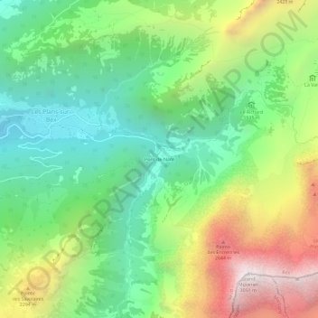
Name: Pont-de-Nant topographic map, elevation, terrain.
Location: Pont-de-Nant, Bex, District d'Aigle, Vaud, 1880, Suisse (46.23156 7.09002 46.27156 7.13002)
Average elevation: 5,725 ft
Minimum elevation: 3,287 ft
Maximum elevation: 9,882 ft
Other topographic maps
Click on a map to view its topography, its elevation and its terrain.
Monts-de-Bex
Suisse > Vaud > District d'Aigle > Bex
Monts-de-Bex, Bex, District d'Aigle, Vaud, 1880, Suisse
Average elevation: 3,205 ft
Solalex
Suisse > Vaud > District d'Aigle > Bex
Solalex, Bex, District d'Aigle, Vaud, 1880, Suisse
Average elevation: 6,073 ft