
Moulin de la Foule topographic map
Interactive map
Click on the map to display elevation.
About this map
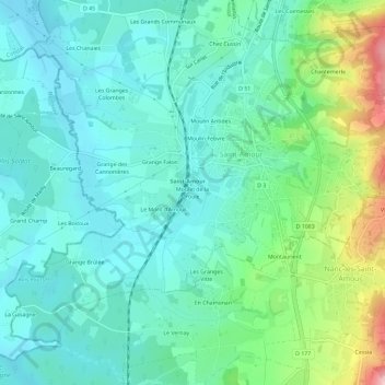
Name: Moulin de la Foule topographic map, elevation, terrain.
Average elevation: 840 ft
Minimum elevation: 656 ft
Maximum elevation: 1,430 ft
Other topographic maps
Click on a map to view its topography, its elevation and its terrain.
Moulin Febvre
France > Bourgogne-Franche-Comté > Jura > Saint-Amour
Moulin Febvre, Saint-Amour, Lons-le-Saunier, Jura, Bourgogne-Franche-Comté, France métropolitaine, 39160, France
Average elevation: 843 ft
Chez Couloz
France > Bourgogne-Franche-Comté > Jura > Saint-Amour
Chez Couloz, Saint-Amour, Lons-le-Saunier, Jura, Bourgogne-Franche-Comté, France métropolitaine, 39160, France
Average elevation: 1,152 ft