
Müssingen topographic map
Interactive map
Click on the map to display elevation.
About this map
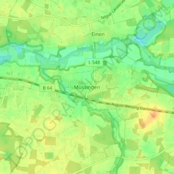
Name: Müssingen topographic map, elevation, terrain.
Average elevation: 184 ft
Minimum elevation: 135 ft
Maximum elevation: 233 ft
Other topographic maps
Click on a map to view its topography, its elevation and its terrain.
Milte
Deutschland > Nordrhein-Westfalen > Kreis Warendorf > Warendorf
Milte, Warendorf, Kreis Warendorf, Nordrhein-Westfalen, Deutschland
Average elevation: 190 ft
Kloster Vinnenberg
Deutschland > Nordrhein-Westfalen > Kreis Warendorf > Warendorf
Kloster Vinnenberg, Warendorf, Kreis Warendorf, Nordrhein-Westfalen, Deutschland
Average elevation: 194 ft