
甘孜镇 topographic map
Interactive map
Click on the map to display elevation.
About this map
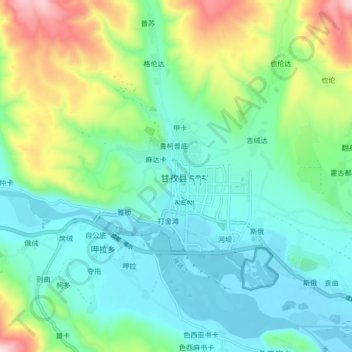
Name: 甘孜镇 topographic map, elevation, terrain.
Location: 甘孜镇, 甘孜县, 甘孜藏族自治州, 四川省, 626700, 中国 (31.58736 99.94870 31.66736 100.02870)
Average elevation: 11,532 ft
Minimum elevation: 10,932 ft
Maximum elevation: 13,238 ft
Other topographic maps
Click on a map to view its topography, its elevation and its terrain.