
高坪镇 topographic map
Interactive map
Click on the map to display elevation.
About this map
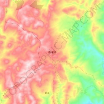
Name: 高坪镇 topographic map, elevation, terrain.
Location: 高坪镇, 金沙县, 毕节市, 贵州省, 中国 (27.20860 106.36061 27.28860 106.44061)
Average elevation: 4,511 ft
Minimum elevation: 3,415 ft
Maximum elevation: 5,276 ft
Other topographic maps
Click on a map to view its topography, its elevation and its terrain.