
Kerdrez topographic map
Interactive map
Click on the map to display elevation.
About this map
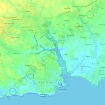
Name: Kerdrez topographic map, elevation, terrain.
Average elevation: 26 ft
Minimum elevation: -7 ft
Maximum elevation: 66 ft
Other topographic maps
Click on a map to view its topography, its elevation and its terrain.
Kerandraon
France > Bretagne > Finistère > Plobannalec-Lesconil > Lesconil
Kerandraon, Lesconil, Plobannalec-Lesconil, Quimper, Finistère, Bretagne, France métropolitaine, 29740, France
Average elevation: 13 ft
Pont Leverien
France > Bretagne > Finistère > Plobannalec-Lesconil > Lesconil > Pont Leverien
Pont Leverien, Lesconil, Plobannalec-Lesconil, Quimper, Finistère, Bretagne, France métropolitaine, 29740, France
Average elevation: 30 ft