
Villiersdorp topographic map
Click on the map to display elevation.
About this map
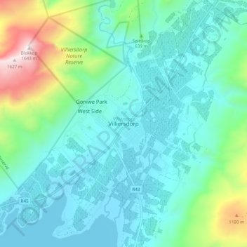
Name: Villiersdorp topographic map, elevation, terrain.
Average elevation: 1,870 ft
Minimum elevation: 997 ft
Maximum elevation: 5,384 ft
Other topographic maps
Click on a map to view its topography, its elevation and its terrain.
Theewaterskloof Dam
South Africa > Western Cape > Theewaterskloof Local Municipality
Average elevation: 1,424 ft
Elandskloof Dam
South Africa > Western Cape > Theewaterskloof Local Municipality
Average elevation: 2,162 ft