
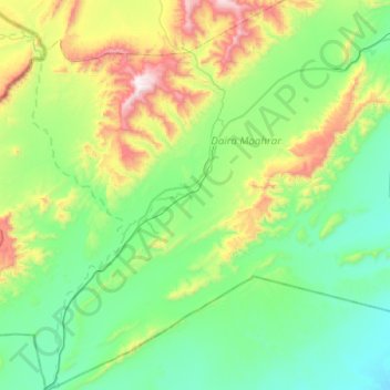
Djeniene Bourezg topographic map
Interactive map
Click on the map to display elevation.
About this map
Name: Djeniene Bourezg topographic map, elevation, terrain.
Location: Djeniene Bourezg, daïra Moghrar, Naâma, Algérie (32.14553 -1.13354 32.56894 -0.69265)
Average elevation: 3,619 ft
Minimum elevation: 2,549 ft
Maximum elevation: 7,172 ft
Djeniene Bourezg est située sur la Route nationale d'Algérie numéro 6, à 70 km au sud de Aïn Sefra, à 999 m d'altitude.