
Fish Creek Pond Campground topographic map
Interactive map
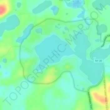
Click on the map to display elevation.
About this map
Name: Fish Creek Pond Campground topographic map, elevation, terrain.
Average elevation: 1,601 ft
Minimum elevation: 1,545 ft
Maximum elevation: 1,749 ft
Other topographic maps
Click on a map to view its topography, its elevation and its terrain.
Saginaw Bay
United States > New York > Franklin County > Santa Clara
Saginaw Bay, Santa Clara, Franklin County, New York, United States
Average elevation: 1,654 ft