
Grondines topographic map
Interactive map
Click on the map to display elevation.
About this map
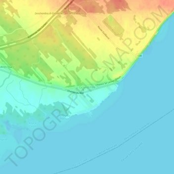
Name: Grondines topographic map, elevation, terrain.
Average elevation: 46 ft
Minimum elevation: 0 ft
Maximum elevation: 148 ft
Other topographic maps
Click on a map to view its topography, its elevation and its terrain.
Grondines
Canada > Québec > Portneuf (MRC) > Deschambault-Grondines
Grondines, Deschambault-Grondines, Portneuf (MRC), Capitale-Nationale, Québec, Canada
Average elevation: 46 ft
Deschambault
Canada > Québec > Portneuf (MRC) > Deschambault-Grondines
Deschambault, Deschambault-Grondines, Portneuf (MRC), Capitale-Nationale, Québec, G0A 1S0, Canada
Average elevation: 36 ft