
Le Boulet topographic map
Interactive map
Click on the map to display elevation.
About this map
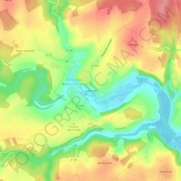
Name: Le Boulet topographic map, elevation, terrain.
Average elevation: 682 ft
Minimum elevation: 525 ft
Maximum elevation: 830 ft
Other topographic maps
Click on a map to view its topography, its elevation and its terrain.
La Petite Poisse
France > Bourgogne-Franche-Comté > Yonne > Druyes-les-Belles-Fontaines > La Petite Poisse
La Petite Poisse, Druyes-les-Belles-Fontaines, Auxerre, Yonne, Bourgogne-Franche-Comté, France métropolitaine, 89560, France
Average elevation: 705 ft