
Sint Hubert topographic map
Interactive map
Click on the map to display elevation.
About this map
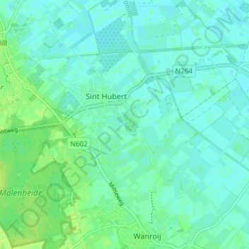
Name: Sint Hubert topographic map, elevation, terrain.
Location: Sint Hubert, Mill en Sint Hubert, Noord-Brabant, Nederland (51.65489 5.78280 51.69279 5.84281)
Average elevation: 46 ft
Minimum elevation: 30 ft
Maximum elevation: 69 ft
Other topographic maps
Click on a map to view its topography, its elevation and its terrain.
Mill en Sint Hubert
Nederland > Noord-Brabant > Mill en Sint Hubert
Mill en Sint Hubert, Noord-Brabant, Nederland
Average elevation: 49 ft
Wilbertoord
Nederland > Noord-Brabant > Mill en Sint Hubert
Wilbertoord, Mill en Sint Hubert, Noord-Brabant, Nederland
Average elevation: 62 ft