
Barat Daya topographic map
Interactive map
Click on the map to display elevation.
About this map
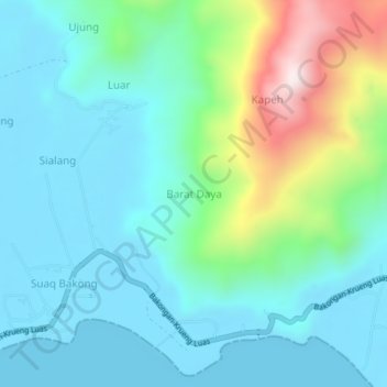
Name: Barat Daya topographic map, elevation, terrain.
Location: Barat Daya, Bakongan Timur, Aceh Selatan, Aceh, Indonesia (2.88647 97.54582 2.92647 97.58582)
Average elevation: 476 ft
Minimum elevation: 0 ft
Maximum elevation: 2,159 ft
Other topographic maps
Click on a map to view its topography, its elevation and its terrain.
Sialang
Indonesia > Aceh > Aceh Selatan
Sialang, Bakongan Timur, Aceh Selatan, Aceh, Indonesia
Average elevation: 210 ft