
Gwbert topographic map
Interactive map
Click on the map to display elevation.
About this map
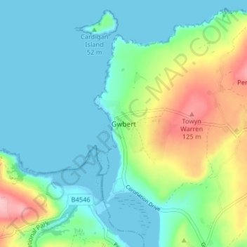
Name: Gwbert topographic map, elevation, terrain.
Location: Gwbert, Ceredigion, Wales, SA43 1PR, United Kingdom (52.09583 -4.70439 52.13583 -4.66439)
Average elevation: 128 ft
Minimum elevation: -3 ft
Maximum elevation: 492 ft
Other topographic maps
Click on a map to view its topography, its elevation and its terrain.
Cardigan Island
United Kingdom > Wales > Gwbert
Cardigan Island, Riversmouth, Gwbert, Ceredigion, Wales, SA43 1PR, United Kingdom
Average elevation: 39 ft