
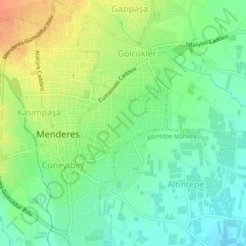
Mithatpaşa Mahallesi topographic map
Interactive map
Click on the map to display elevation.
About this map
Name: Mithatpaşa Mahallesi topographic map, elevation, terrain.
Location: Mithatpaşa Mahallesi, Menderes, Izmir, Aegean Region, Turkey (38.24934 27.13588 38.25634 27.14842)
Average elevation: 361 ft
Minimum elevation: 302 ft
Maximum elevation: 446 ft
Other topographic maps
Click on a map to view its topography, its elevation and its terrain.
Oğlananası
Turkey > Menderes > Oğlananası
Oğlananası, Menderes, Izmir, Aegean Region, 35470, Turkey
Average elevation: 449 ft