
Le Lorrain topographic map
Interactive map
Click on the map to display elevation.
About this map
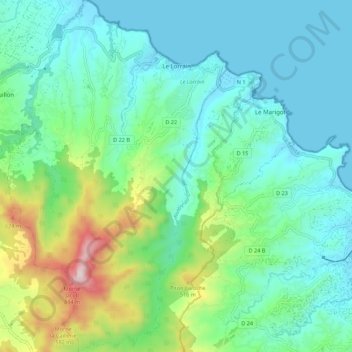
Name: Le Lorrain topographic map, elevation, terrain.
Location: Le Lorrain, La Trinité, Martinique, 97214, France (14.74639 -61.10821 14.85242 -61.03960)
Average elevation: 627 ft
Minimum elevation: -7 ft
Maximum elevation: 2,756 ft