
Mayrhofen topographic map
Interactive map
Click on the map to display elevation.
About this map
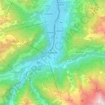
Name: Mayrhofen topographic map, elevation, terrain.
Location: Mayrhofen, Bezirk Schwaz, Tyrol, 6290, Autriche (47.12722 11.82387 47.20722 11.90387)
Average elevation: 4,311 ft
Minimum elevation: 1,916 ft
Maximum elevation: 9,642 ft