
Daqing topographic map
Interactive map
Click on the map to display elevation.
About this map
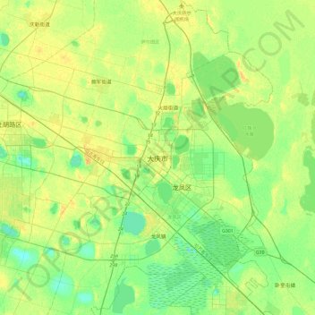
Name: Daqing topographic map, elevation, terrain.
Location: Daqing, 萨尔图区, 大庆市, Heilongjiang, Chine (46.43690 124.94148 46.75690 125.26148)
Average elevation: 486 ft
Minimum elevation: 453 ft
Maximum elevation: 522 ft
Other topographic maps
Click on a map to view its topography, its elevation and its terrain.
District d'Acheng
Chine > Heilongjiang > Harbin
District d'Acheng, Harbin, Heilongjiang, Chine
Average elevation: 801 ft
District de Daoli
District de Daoli, Harbin, Heilongjiang, 150000, Chine
Average elevation: 512 ft
Mohe
Chine > Heilongjiang > 漠河市 > 西林吉镇
Mohe, 西林吉镇, 漠河市, Préfecture de Daxing'anling, Heilongjiang, 165399, Chine
Average elevation: 1,762 ft
黑龙江
Chine > Heilongjiang > 抚远镇
黑龙江, 抚远镇, 抚远市, 佳木斯市, Heilongjiang, 154000, Chine
Average elevation: 141 ft