
齐洼 topographic map
Interactive map
Click on the map to display elevation.
About this map
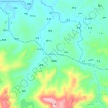
Name: 齐洼 topographic map, elevation, terrain.
Location: 齐洼, 王里河村, 新县, 息县, 信阳市, 河南省, 中国 (31.67693 114.91861 31.71693 114.95861)
Average elevation: 502 ft
Minimum elevation: 266 ft
Maximum elevation: 1,125 ft