
Howqua topographic map
Interactive map
Click on the map to display elevation.
About this map
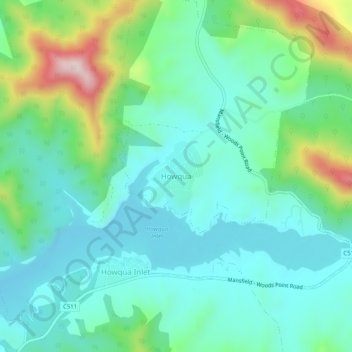
Name: Howqua topographic map, elevation, terrain.
Location: Howqua, Shire of Mansfield, Victoria, Australia (-37.23276 146.12176 -37.19276 146.16176)
Average elevation: 1,191 ft
Minimum elevation: 879 ft
Maximum elevation: 2,146 ft