
Aliaga topographic map
Interactive map
Click on the map to display elevation.
About this map
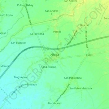
Name: Aliaga topographic map, elevation, terrain.
Location: Aliaga, Nueva Ecija, Central Luzon, 3111, Philippines (15.46328 120.80556 15.54328 120.88556)
Average elevation: 79 ft
Minimum elevation: 56 ft
Maximum elevation: 108 ft
Other topographic maps
Click on a map to view its topography, its elevation and its terrain.
Pantoc
Philippines > Nueva Ecija > Aliaga
Pantoc, Aliaga, Nueva Ecija, Central Luzon, 3111, Philippines
Average elevation: 82 ft