
Tilmouni topographic map
Interactive map
Click on the map to display elevation.
About this map
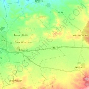
Name: Tilmouni topographic map, elevation, terrain.
Location: Tilmouni, Daïra Mostefa Ben Brahim, Sidi Bel Abbès, Algérie (35.12531 -0.59561 35.23940 -0.44901)
Average elevation: 1,709 ft
Minimum elevation: 1,417 ft
Maximum elevation: 2,221 ft