

Long Pond topographic map
Click on the map to display elevation.
Long Pond
Long Pond is named after the unique wetland topography formed by the Tunkhannock Creek. Within the Long Pond community, public access lands are owned and protected by The Bethlehem Authority, Nature Conservancy, Wildlands Conservancy County of Monroe Open Space Program, , PA Game Commission and PA Department of Forest and Waters. Long Pond is home to many species of unique plants and animals.
About this map
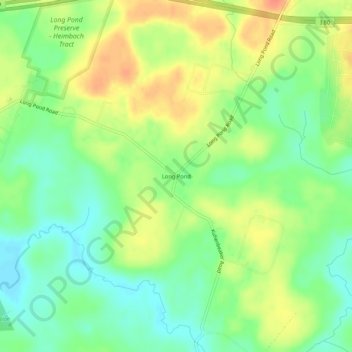
Name: Long Pond topographic map, elevation, terrain.
Average elevation: 1,873 ft
Minimum elevation: 1,804 ft
Maximum elevation: 1,955 ft
Monroe County trails, hiking, mountain biking, running and outdoor activities
Other topographic maps
Click on a map to view its topography, its elevation and its terrain.
Indian Mountain Lake
United States > Pennsylvania > Monroe County > Tunkhannock Township > Indian Mountain Lake
Average elevation: 1,660 ft

Indain Mountain Lake Beach
United States > Pennsylvania > Monroe County > Tunkhannock Township > Indian Mountain Lake
Average elevation: 1,837 ft