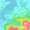
A Pontenova topographic map
Click on the map to display elevation.
A Pontenova
The Turia River (250 m altitude) gives its name to the valley. The Turia Valley is surrounded by hills and mountains, including, Sierra de Piedafita (900 m), Sierra de Ouroso (1033 m), Sierras de Dendin (900 m), Sierra de Teixedais (900 m) and Sierra de Eirua (700 m).
About this map

Name: A Pontenova topographic map, elevation, terrain.
Location: A Pontenova, A Mariña Oriental, Lugo, Galicia, Spain (43.25563 -7.26437 43.39631 -7.08816)
Average elevation: 1,411 ft
Minimum elevation: 171 ft
Maximum elevation: 3,084 ft
Other topographic maps
Click on a map to view its topography, its elevation and its terrain.