
Uncía topographic map
Interactive map
Click on the map to display elevation.
About this map
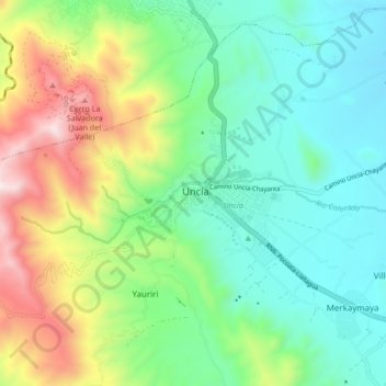
Name: Uncía topographic map, elevation, terrain.
Location: Uncía, Provincia Rafael Bustillo, Potosí, Bolivia (-18.50700 -66.60875 -18.42700 -66.52875)
Average elevation: 13,120 ft
Minimum elevation: 12,100 ft
Maximum elevation: 15,423 ft