Geolocate

Overton topographic map

Click on the map to display elevation.

About this map

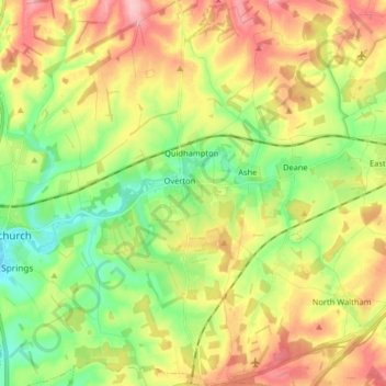
Name: Overton topographic map, elevation, terrain.

Location: Overton, Basingstoke and Deane, Hampshire, England, United Kingdom (51.19051 -1.29673 51.29175 -1.21443)

Average elevation: 413 ft

Minimum elevation: 217 ft

Maximum elevation: 656 ft

Other topographic maps

Click on a map to view its topography, its elevation and its terrain.

Gear up for your next adventure:

🎒Day Hiking Backpack - Lightweight backpack perfect for day trips and outdoor adventures
🎒Trekking Poles - Sturdy poles for balance and stability on rough terrain
🗃️Trail First Aid Kit - Essential kit for outdoor injuries and emergencies
🔭Compact Binoculars - HD vision for scouting terrain and identifying distant landmarks
🎒Outdoor Daypacks - Lightweight backpacks designed for carrying maps and essential gear

As an Amazon Associate, this site earns from qualifying purchases at no extra cost to you.