
Nwoya topographic map
Interactive map
Click on the map to display elevation.
About this map
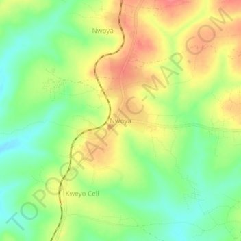
Name: Nwoya topographic map, elevation, terrain.
Location: Nwoya, Northern Region, Uganda (2.61370 31.98046 2.65370 32.02046)
Average elevation: 3,294 ft
Minimum elevation: 3,182 ft
Maximum elevation: 3,412 ft
The coordinates of the town are 2°38'06.0"N, 32°00'00.0"E (Latitude:2.6350; Longitude:32.0000). Nwoya Town lies at an average elevation of 990 metres (3,250 ft) above sea level.