
Papara topographic map
Interactive map
Click on the map to display elevation.
About this map
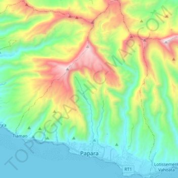
Name: Papara topographic map, elevation, terrain.
Location: Papara, Îles du Vent, Polynésie française, 98712, France (-17.78018 -149.56379 -17.64364 -149.45215)
Average elevation: 1,706 ft
Minimum elevation: 0 ft
Maximum elevation: 5,656 ft