
Bagalangit topographic map
Interactive map
Click on the map to display elevation.
About this map
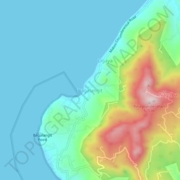
Name: Bagalangit topographic map, elevation, terrain.
Location: Bagalangit, Mabini, Batangas, Calabarzon, Philippines (13.70548 120.86457 13.74548 120.90457)
Average elevation: 397 ft
Minimum elevation: 0 ft
Maximum elevation: 1,621 ft