
Dawki topographic map
Interactive map
Click on the map to display elevation.
About this map
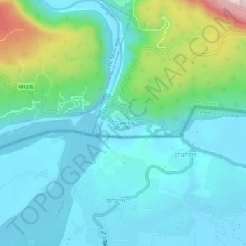
Name: Dawki topographic map, elevation, terrain.
Location: Dawki, Amlarem, West Jaintia Hills, Meghalaya, 793109, India (25.16563 92.00157 25.20563 92.04157)
Average elevation: 325 ft
Minimum elevation: 26 ft
Maximum elevation: 1,499 ft