
Héa topographic map
Interactive map
Click on the map to display elevation.
About this map
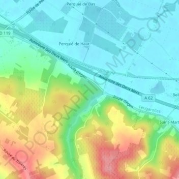
Name: Héa topographic map, elevation, terrain.
Average elevation: 226 ft
Minimum elevation: 102 ft
Maximum elevation: 479 ft
Other topographic maps
Click on a map to view its topography, its elevation and its terrain.
Baïse
France > Nouvelle-Aquitaine > Feugarolles
Baïse, Feugarolles, Nérac, Lot-et-Garonne, Nouvelle-Aquitaine, France métropolitaine, 47230, France
Average elevation: 151 ft
Prat Barrat
France > Nouvelle-Aquitaine > Feugarolles
Prat Barrat, Feugarolles, Nérac, Lot-et-Garonne, Nouvelle-Aquitaine, France métropolitaine, 47230, France
Average elevation: 121 ft