
Sayada topographic map
Interactive map
Click on the map to display elevation.
About this map
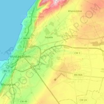
Name: Sayada topographic map, elevation, terrain.
Location: Sayada, daïra Kheireddine, Mostaganem, Algérie (35.87361 0.09981 35.99370 0.20764)
Average elevation: 512 ft
Minimum elevation: -3 ft
Maximum elevation: 1,306 ft