
Gandesa topographic map
Interactive map
Click on the map to display elevation.
About this map
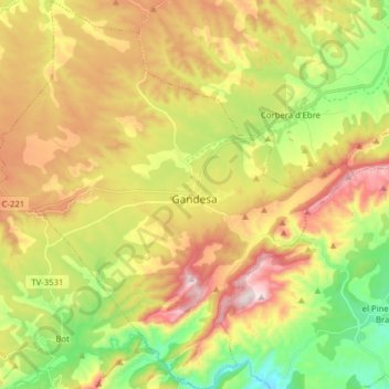
Name: Gandesa topographic map, elevation, terrain.
Location: Gandesa, Terra Alta, Tarragona, Catalonië, 43780, Spanje (40.99418 0.35667 41.11229 0.50300)
Average elevation: 1,191 ft
Minimum elevation: 276 ft
Maximum elevation: 2,260 ft