
Los Barrancos topographic map
Interactive map
Click on the map to display elevation.
About this map
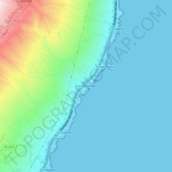
Name: Los Barrancos topographic map, elevation, terrain.
Average elevation: 387 ft
Minimum elevation: 0 ft
Maximum elevation: 1,959 ft
Other topographic maps
Click on a map to view its topography, its elevation and its terrain.
Puertito de Güímar
Puertito de Güímar, Güímar, Santa Cruz de Tenerife, Canarias, 38508, España
Average elevation: 187 ft
La Corujera
España > Güímar > La Corujera
La Corujera, Güímar, Santa Cruz de Tenerife, Canarias, 38500, España
Average elevation: 1,690 ft
El Escobonal
El Escobonal, Güímar, Santa Cruz de Tenerife, Canarias, 38591, España
Average elevation: 1,827 ft
El Socorro
España > Güímar > El Socorro
El Socorro, Güímar, Santa Cruz de Tenerife, Canarias, 38508, España
Average elevation: 138 ft