
Sungai Maong topographic map
Interactive map
Click on the map to display elevation.
About this map
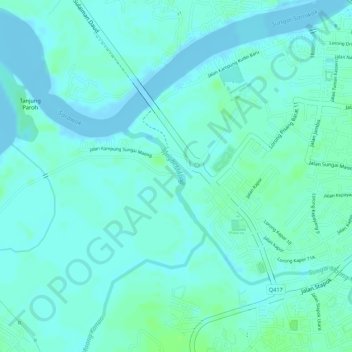
Name: Sungai Maong topographic map, elevation, terrain.
Average elevation: 13 ft
Minimum elevation: -13 ft
Maximum elevation: 33 ft
Other topographic maps
Click on a map to view its topography, its elevation and its terrain.
Taman Budaya
Malaysia > Sarawak > Kuching > Kuching
Taman Budaya, Kuching, Kuching Division, Sarawak, 93000, Malaysia
Average elevation: 30 ft