
Stanleyville topographic map
Interactive map
Click on the map to display elevation.
About this map
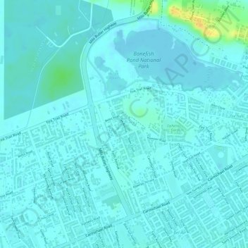
Name: Stanleyville topographic map, elevation, terrain.
Location: Stanleyville, New Providence, The Bahamas (25.02929 -77.37991 25.03167 -77.37809)
Average elevation: 23 ft
Minimum elevation: 7 ft
Maximum elevation: 108 ft
Other topographic maps
Click on a map to view its topography, its elevation and its terrain.
Highbury Park
Highbury Park, New Providence, The Bahamas
Average elevation: 23 ft
Charlotteville
Charlotteville, New Providence, The Bahamas
Average elevation: 16 ft