
La Thuile topographic map
Interactive map
Click on the map to display elevation.
About this map
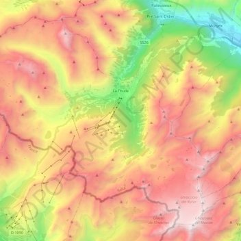
Name: La Thuile topographic map, elevation, terrain.
Location: La Thuile, Aosta Valley, Italy (45.63080 6.80801 45.76364 7.02832)
Average elevation: 7,405 ft
Minimum elevation: 2,927 ft
Maximum elevation: 11,345 ft