
Lachish Regional Council topographic map
Interactive map
Click on the map to display elevation.
About this map
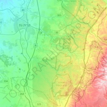
Name: Lachish Regional Council topographic map, elevation, terrain.
Location: Lachish Regional Council, South District, 00000, Israel (31.41218 34.65380 31.66660 34.96118)
Average elevation: 991 ft
Minimum elevation: 203 ft
Maximum elevation: 2,815 ft