
Benamargosa topographic map
Interactive map
Click on the map to display elevation.
About this map
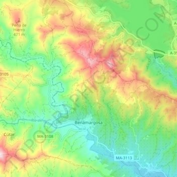
Name: Benamargosa topographic map, elevation, terrain.
Location: Benamargosa, La Axarquía, Malaga, Andalusia, 29718, Spain (36.81595 -4.21461 36.87861 -4.17756)
Average elevation: 843 ft
Minimum elevation: 187 ft
Maximum elevation: 1,913 ft