
Rillaar topographic map
Interactive map
Click on the map to display elevation.
About this map
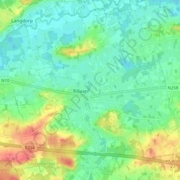
Name: Rillaar topographic map, elevation, terrain.
Location: Rillaar, Aarschot, Vlaams-Brabant, Vlaanderen, 3202, België (50.95524 4.86163 50.99660 4.93352)
Average elevation: 92 ft
Minimum elevation: 26 ft
Maximum elevation: 230 ft
Other topographic maps
Click on a map to view its topography, its elevation and its terrain.
Gelrode
België > Vlaanderen > Aarschot > Gelrode
Gelrode, Aarschot, Vlaams-Brabant, Vlaanderen, 3200, België
Average elevation: 102 ft