
Saint-Pierre topographic map
Interactive map
Click on the map to display elevation.
About this map
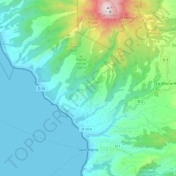
Name: Saint-Pierre topographic map, elevation, terrain.
Location: Saint-Pierre, Martinique, 97250, France (14.72881 -61.21405 14.81462 -61.13353)
Average elevation: 935 ft
Minimum elevation: 0 ft
Maximum elevation: 4,508 ft