Geolocate

Scarborough topographic map

Click on the map to display elevation.

About this map
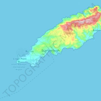
Name: Scarborough topographic map, elevation, terrain.

Location: Scarborough, Tobago, Trinidad and Tobago (11.02529 -60.89502 11.34529 -60.57502)

Average elevation: 112 ft

Minimum elevation: 0 ft

Maximum elevation: 1,844 ft

Gear up for your next adventure:

🏕️Tent Footprint - Protect your tent base from wear
🌡️Handheld Weather Meters - Measure wind, temp, and pressure for safe mountain travel
🧤Tactile Hiking Gloves - Keep hands warm while operating GPS and smartphone screens
🚁Photography Drones - Capture stunning aerial views of landforms and topography
📡GPS Antenna Upgrade - Enhance GPS reception in remote terrain

As an Amazon Associate, this site earns from qualifying purchases at no extra cost to you.