
Nagdhar topographic map
Interactive map
Click on the map to display elevation.
About this map
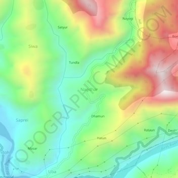
Name: Nagdhar topographic map, elevation, terrain.
Location: Nagdhar, Mandi, Himachal Pradesh, India (31.67329 77.05024 31.71329 77.09024)
Average elevation: 3,924 ft
Minimum elevation: 2,707 ft
Maximum elevation: 5,912 ft