
Thank you for supporting this site ❤️
Make a donation
Make a donation
Gear up for your next adventure:
As an Amazon Associate, this site earns from qualifying purchases at no extra cost to you.
Tambogrande topographic map
Click on the map to display elevation.
Thank you for supporting this site ❤️
Make a donation
Make a donation
Gear up for your next adventure:
As an Amazon Associate, this site earns from qualifying purchases at no extra cost to you.
About this map
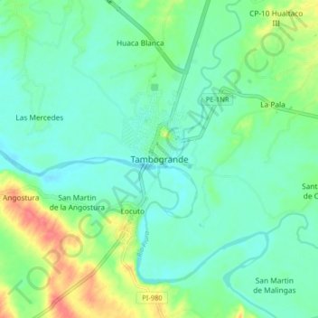
Name: Tambogrande topographic map, elevation, terrain.
Location: Tambogrande, Tambo Grande, Province of Piura, Piura, Peru (-4.97535 -80.38240 -4.89535 -80.30240)
Average elevation: 240 ft
Minimum elevation: 180 ft
Maximum elevation: 397 ft
Thank you for supporting this site ❤️
Make a donation
Make a donation
Gear up for your next adventure:
As an Amazon Associate, this site earns from qualifying purchases at no extra cost to you.