Geolocate

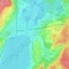
Pöcking topographic map

Click on the map to display elevation.

About this map
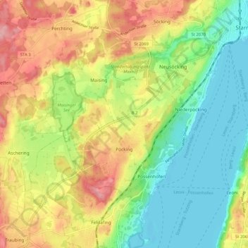
Name: Pöcking topographic map, elevation, terrain.

Location: Pöcking, Landkreis Starnberg, Bavaria, 82343, Germany (47.94828 11.23065 47.99888 11.33215)

Average elevation: 2,093 ft

Minimum elevation: 1,909 ft

Maximum elevation: 2,333 ft

Other topographic maps

Click on a map to view its topography, its elevation and its terrain.
Söcking

Germany > Bavaria > Landkreis Starnberg > Starnberg

Average elevation: 2,136 ft

Whirlpool

Germany > Bavaria > Landkreis Starnberg > Gauting > Königswiesen

Average elevation: 1,932 ft
Percha

Germany > Bavaria > Landkreis Starnberg > Starnberg

Average elevation: 1,998 ft

Leoni

Germany > Bavaria > Landkreis Starnberg

Average elevation: 2,021 ft

Hochstadt

Germany > Bavaria > Landkreis Starnberg

Average elevation: 1,998 ft

Stegen

Germany > Bavaria > Landkreis Starnberg > Inning am Ammersee

Average elevation: 1,795 ft

Stockdorf

Germany > Bavaria > Landkreis Starnberg > Gauting

Average elevation: 1,844 ft

Gear up for your next adventure:

🍳Camping Cook Set - Complete cookware for outdoor meals
📷Action Cameras - Rugged cameras to document your journeys across rugged terrain
🧯Portable Fire Pit - Compact fire pit for camping spots
🪶Wildlife Field Guides - Learn animal tracking and species ID
🧢Sun Protection Hats - Wide-brimmed and UPF-rated hats for high-altitude sun safety

As an Amazon Associate, this site earns from qualifying purchases at no extra cost to you.