
Thank you for supporting this site ❤️
Make a donation
Make a donation
Gear up for your next adventure:
As an Amazon Associate, this site earns from qualifying purchases at no extra cost to you.
Allermöhe topographic map
Click on the map to display elevation.
Thank you for supporting this site ❤️
Make a donation
Make a donation
Gear up for your next adventure:
As an Amazon Associate, this site earns from qualifying purchases at no extra cost to you.
About this map
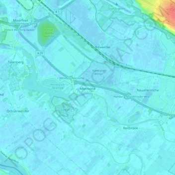
Name: Allermöhe topographic map, elevation, terrain.
Location: Allermöhe, Bergedorf, Hamburg, 21037, Germany (53.46354 10.08935 53.50435 10.19962)
Average elevation: 13 ft
Minimum elevation: -10 ft
Maximum elevation: 164 ft
Thank you for supporting this site ❤️
Make a donation
Make a donation
Gear up for your next adventure:
As an Amazon Associate, this site earns from qualifying purchases at no extra cost to you.