
Kluizen topographic map
Interactive map
Click on the map to display elevation.
About this map
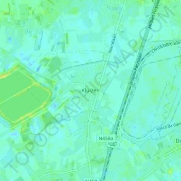
Name: Kluizen topographic map, elevation, terrain.
Location: Kluizen, Gent, Oost-Vlaanderen, Vlaanderen, 9940, België (51.13471 3.71261 51.17471 3.75261)
Average elevation: 16 ft
Minimum elevation: 3 ft
Maximum elevation: 49 ft