Geolocate

Trinidad topographic map

Click on the map to display elevation.

About this map
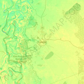
Name: Trinidad topographic map, elevation, terrain.

Location: Trinidad, Santísima Trinidad, Cercado, Beni, Bolivia (-14.99494 -65.06449 -14.67494 -64.74449)

Average elevation: 495 ft

Minimum elevation: 449 ft

Maximum elevation: 538 ft

Other topographic maps

Click on a map to view its topography, its elevation and its terrain.

Casarabe

Bolivia > Beni > Cercado > Santísima Trinidad

Average elevation: 528 ft

San Javier

Bolivia > Beni > Cercado

Average elevation: 502 ft

Gear up for your next adventure:

📷Action Cameras - Rugged cameras to document your journeys across rugged terrain
🪶Camping Sleeping Pad - Comfortable sleeping pad for backpacking
🗃️Trail First Aid Kit - Essential kit for outdoor injuries and emergencies
🧭Compass with Lanyard - Easy‑carry compass for navigation
🪶LED Camping Lantern - Bright lantern for camp lighting

As an Amazon Associate, this site earns from qualifying purchases at no extra cost to you.