Mount Kailash topographic map
Click on the map to display elevation.
Mount Kailash
Mount Kailash (also Kailasa, Gang Tise and Gang Rinpoche or Kangrinboqê) is a mountain in Ngari Prefecture, Tibet Autonomous Region of China. It lies in the Gangdise Shan mountain range of the Transhimalaya, in the western part of the Tibetan Plateau. The peak of Mount Kailash is located at an elevation of 6,638 m (21,778 ft), near the western trijunction between China, India and Nepal.
About this map
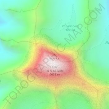
Name: Mount Kailash topographic map, elevation, terrain.
Average elevation: 18,885 ft
Minimum elevation: 17,215 ft
Maximum elevation: 21,604 ft
Other topographic maps
Click on a map to view its topography, its elevation and its terrain.