Geolocate

Rodellar topographic map

Click on the map to display elevation.

About this map
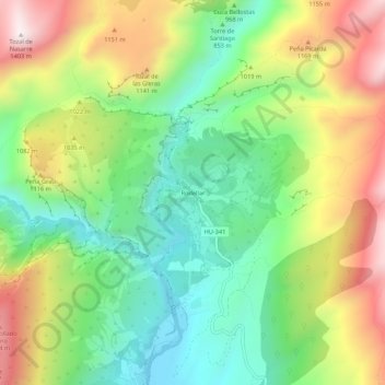
Name: Rodellar topographic map, elevation, terrain.

Location: Rodellar, Bierge, Somontano de Barbastro, Huesca, Aragon, 22144, Spain (42.26237 -0.09814 42.30237 -0.05814)

Average elevation: 3,074 ft

Minimum elevation: 2,073 ft

Maximum elevation: 4,551 ft

Other topographic maps

Click on a map to view its topography, its elevation and its terrain.

Salas Bajas

Spain > Aragon > Somontano de Barbastro

Average elevation: 1,490 ft

Gear up for your next adventure:

📡Handheld GPS Device - Reliable handheld GPS for outdoor navigation
🌎3D Topographic Globes - Raised relief globes for a tactile understanding of geography
🩹Survival Bandages - High‑quality bandages for emergencies
🚪Portable Camp Chair - Foldable chair for comfort at camp
☕Camping Coffee Makers - Enjoy premium coffee at the summit or campsite

As an Amazon Associate, this site earns from qualifying purchases at no extra cost to you.